
Eyes in the Sky: MSU supports disaster preparation, planning with NOAA and FEMA
Contact: Nicole Thomas
JACKSON, Miss.—When rivers overflow, flood waters move quickly, threatening to destroy people and property. A recent training exercise led by Mississippi State University demonstrates the potential of uncrewed aircraft systems to provide high-resolution imagery in real time during disaster events, giving officials up-to-date information they need to best protect the communities they serve.
MSU’s Raspet Flight Research Laboratory partnered with the National Oceanic and Atmospheric Association and the Federal Emergency Management Agency Region 4 to conduct flights in Mississippi in mid-November.
“This flight exercise demonstrates how leveraging the capabilities of large uncrewed aircraft increases the accuracy and efficiency of flood data collection and provides rapid flood impact assessment information during an emergency scenario to get help to those who need it,” said Jamie Dyer, MSU professor of meteorology and climatology.
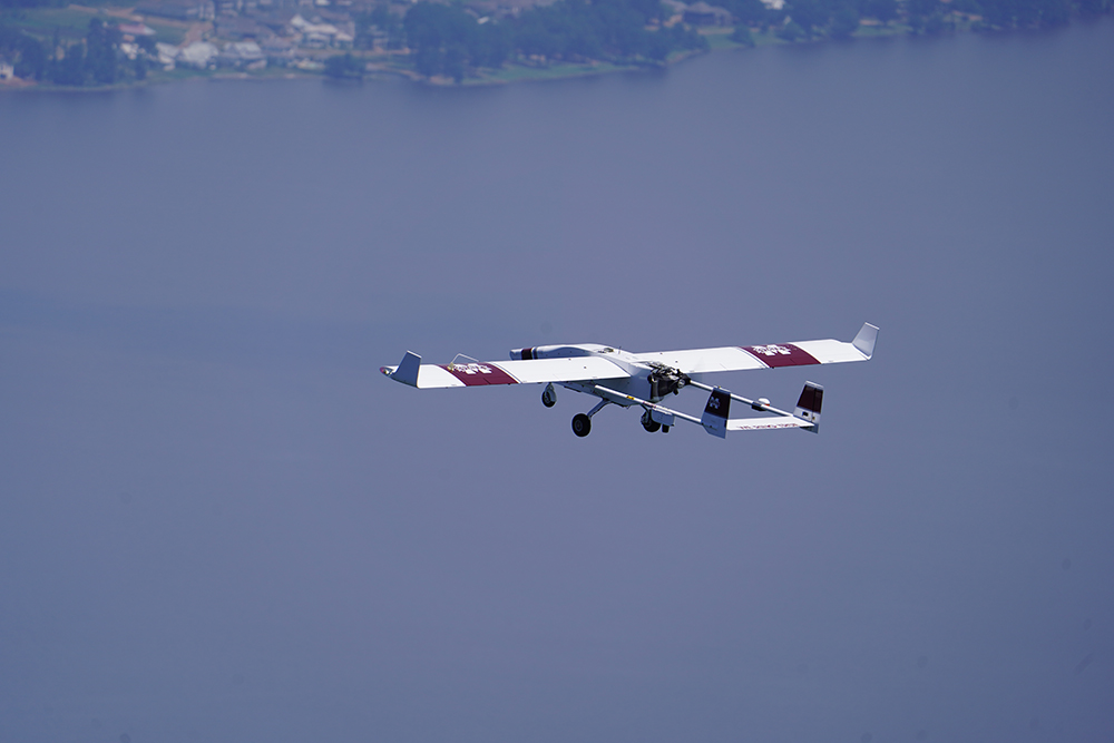
Raspet deployed its TigerShark, a large uncrewed aircraft equipped with a complex camera payload, to examine representative areas of interest during a disaster response event. High resolution, detailed map-quality images were delivered to a team on the ground in real time.
“This exercise brings multiple agencies together to observe how needed data is collected, processed and shared simultaneously and in real-time, increasing efficiency and responsiveness through the application of new technologies,” said Bryan Cole, NOAA’s Director of Uncrewed Systems Research Transitions Office.
Although Mississippi is now experiencing drought conditions, the frequency of flooding occurrences has increased. According to the U.S. Environmental Protection Agency, the average number of flood events has progressively accelerated since 1950, creating the need for better, faster and more advanced approaches to flood response.
The mission further advances Dyer’s research at MSU’s Northern Gulf Institute, a NOAA Cooperative Institute, using Raspet’s fleet of uncrewed aircraft and the latest imaging and communications technology to better predict a flood before it occurs.
“High resolution, detailed images captured during previous flights provide a baseline for us to see where water exists, which we can use to define areas at risk of becoming inundated during a flood event,” Dyer said.
With aligned interests of disaster management and data collection between NOAA and FEMA, Raspet proposed a similar mission with both government agencies for post-disaster flood assessments.
“The ability to predict and respond to a flood in real time allows government authorities to make timely decisions during a disaster and builds capacity for first-responder operations,” said Raspet’s Associate Director of Aviation Program Management Bryan Farrell.
As the initiative moves forward, key personnel will meet to assess the disaster preparedness exercise and discuss how large UAS capabilities can be implemented in an actual emergency.
Mississippi State University is taking care of what matters. Learn more at www.msstate.edu.